
When taking on the Mount Kili adventure, knowing the best route to climb Mount Kilimanjaro for a successful summit climb is crucial.
There’s nothing like standing at the top of Mount Kilimanjaro, the world’s highest freestanding mountain, as the sunrise breaks over the landscape. It’s a truly breathtaking, once-in-a-lifetime trek that attracts more than 35,000 people a year to Tanzania.
But did you know only two-thirds make it to the summit? The rest are forced to turn around due to altitude sickness and other health problems.
So, how can you improve your chances of making it to the top? By choosing the best Kilimanjaro route for your level of fitness. You must select the correct route to reach the summit.
There is more than one way to Uhuru Peak, and your choice can either improve your chances or put you at a significant disadvantage. To help you figure out which is the best route to climb Mount Kilimanjaro, we’ve put together the ultimate guide on the seven Kilimanjaro routes.
Below is a complete breakdown of what to expect and the pros and cons to help you make the most of your time on the mountain.
Which is the best route to climb mount Kilimanjaro?
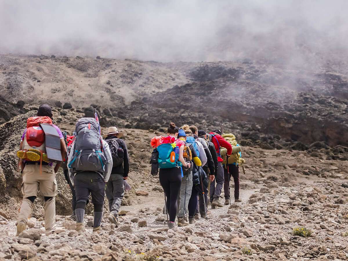
Climbing Mount Kilimanjaro is one of the most popular and challenging mountain climbs. It is also a bucket list item for many people who have never climbed a mountain.
As you plan your trip, the question often arises about which route to climb. There are two primary routes to choose from when climbing Mount Kilimanjaro – the Machame and the Marangu routes.
However, there are several other routes available. Let us break this down further.
Northern circuit route

Distance: 88km / 8 – 9 Days
Want to boost your chances of summiting Mount Kilimanjaro and avoiding altitude sickness? The Northern Circuit is your best bet, as it is a relatively easy route.
The newest Kilimanjaro route is a firm favourite with trekking enthusiasts and has one of the highest success rates.
Over eight or nine days, you’ll completely circumnavigate Kilimanjaro. The route gives you ample time to acclimate and take in Rongai and Shira’s spectacular vistas.
Not enough to tempt you? The Northern Circuit is also one of the direct routes up Kilimanjaro. You’ll get to avoid the crowds and experience the mountain’s remote wilderness in peace.
The trek follows the Lemosho trail initially, but instead of following a southern traverse like the other west-approaching routes, you’ll go up the rarely-visited northern slopes.
With a high success rate, beautiful scenery, and hardly any crowds, the Northern Circuit is one of the best routes on Kilimanjaro.
1. 9 days north circuit route itinerary
| NUMBER OF DAYS | NORTH CIRCUIT ROUTE | ELEVATION | DISTANCE | HIKING HOURS< | HABITAT |
|---|---|---|---|---|---|
| DAY 1 | Londorossi Gate to Mti Mkubwa | 7,742 ft to 9,498 ft | 6 km/4 miles | 3 – 4 hours | Rain Forest |
| DAY 2 | Mti Mkubwa to Shira 1 Camp | 9,498 ft to 11,500 ft | 8 km/5 miles | 5 – 6 hours | Heath |
| DAY 3 | Shira 1 Camp to Shira 2 Camp | 11,500 ft to 12,500 ft | 7 km/4 miles | 3 – 4 hours | Heath |
| DAY 4 | Shira 2 Camp to Lava Tower Lava Tower to Moir Hut | 12,500 ft to 15,190 ft 15,190 ft to 13,580 ft | 7 km/4 miles 7 km/4 miles | 3 – 4 hours 2 – 3 hours | Alpine Desert Alpine Desert |
| DAY 5 | Moir Hut to Buffalo Camp | 13,580 ft to 13,200 ft | 12 km/7 miles | 5 – 7 hours | Alpine Desert |
| DAY 6 | Buffalo Camp to Third Cave | 13,200 ft to 12,700 ft | 8 km/5 miles | 5 – 7 hours | Heath |
| DAY 7 | Third Cave to School Hut | 12,700 ft to 15,600 ft | 5 km/3 miles | 4 – 5 hours | Alpine Desert |
| DAY 8 | School Hut to Uhuru Peak Uhuru Peak to Mweka Camp | 15,600 ft to 19,341 ft 19,341 ft to 10,065 | 6 km/4 miles 12 km/7 miles | 6 – 8 hours 4 – 6 hours | Arctic |
| DAY 9 | Mweka Camp to Mweka Gate | 10,065 ft to 5,380 ft | 10 km/6 miles | 3 – 4 hours | Rain Forest |
Lemosho route

Distance: 67km / 7 – 8 Days
Lemosho is a beautiful route up Kilimanjaro. Starting from the West, you’ll trek past a remote rainforest, go through the Lemosho Glades, and see panoramic vistas of the mountain before joining up with the Machame Route.
From there, you’ll follow the southern circuit and walk past the Lava Tower, Barranco Wall, and Barafu. The only downside? It’s one of the more expensive Kilimanjaro routes. Usually, a longer trek of seven or eight days and more remote does come with a higher price tag.
But if you don’t mind a longer itinerary and want a higher success rate with showstopping natural beauty, Lemosho is worth every penny.
Pros:
Beautiful scenery
Plenty of time for acclimatization
High success rate
Fully catered camping
Spectacular views
Cons:
Expensive route
Low traffic until you join up with the Machame route
1. 8 days Lemosho itinerary
| NUMBER OF DAYS | LEMOSHO ROUTE | ELEVATION | DISTANCE | HIKING HOURS | HABITAT |
|---|---|---|---|---|---|
| DAY 1 | Londorossi Gate to Mti Mkubwa | 7,743 ft to 9,498 ft | 6 km/4 miles | 3 – 4 hours | Rainforest |
| DAY 2 | Mti Mkubwa to Shira 1 Camp | 9,498 ft to 11,499 ft | 8 km/5 miles | 5 – 6 hour | Heath |
| DAY 3 | Shira 1 Camp to Shira 2 Camp | 9,498 ft to 11,499 feet | 11 km/7 miles | 5 – 7 hours | Heath |
| DAY 4 | Shira 2 Camp to Lava Tower Lava Tower to Barranco Camp | 12,480 ft to 15,190 ft 15,190 ft to 12,959 ft | 7 km/4 miles 3 km/2 miles | 4 – 5 hours 2 – 3 hours | Alpine Desert |
| DAY 5 | Barranco Camp to Karanga Camp | 12,959 ft to 13,231 ft | 5 km/3 miles | 4 to 5 hours | Alpine Desert |
| DAY 6 | Karanga Camp to Barafu Camp | 13,232 ft to 14,948 ft | 4 km/2 miles | 4 – 5 hours | Alpine Desert |
| DAY 7 | Barafu Camp to Uhuru Peak Uhuru Peak to Mweka Camp | 14,948 ft to 19,341 ft 19,341 ft to 10,171 ft | 5 km/3 miles 12 km/7 miles | 7 – 8 hours 4 – 6 hours | Ice Camp Rainforest |
| DAY 8 | Mweka Camp to Mweka Gate | 10,171 ft to 5,381 ft | 10 km/6 miles | 3 – 4 hours | Rainforest |
Shira route

Distance: 58km / 6 – 7 Days
The Shira route approaches from the West and is almost identical to Lemosho.
However, its difference lies in its starting point. Instead of spending the first stage of the climb walking through the rainforest zone, you skip it.
You can walk on a four-wheel drive to the Shira 1 camp or as far as possible.
While this sounds like excellent news, it does put your body at risk. You are catapulting yourself to 3,500 meters / 11,500 feet without proper acclimatisation.
The result? You could experience altitude sickness on the first day while camping at 11,500 feet. If you know your body will react positively to the high altitude starting point, you can expect a route that avoids the crowded campsites and trails until it re-joins the Machame route.
While Shira’s success rates are lower than other routes, you can boost your chances by spending a night at Karanga Valley.
1. 7 days Shira route itinerary
| NUMBER OF DAYS | SHIRA ROUTE | ELEVATION | DISTANCE | HIKING HOURS | HABITAT |
|---|---|---|---|---|---|
| DAY 1 | Shira Gate to Simba Camp | 11,800 ft to 11,800 ft | 4 km/2 miles | 1 hour | Heath |
| DAY 2 | Simba Camp to Shira 2 Camp | 11,800 ft to 12,500 ft | 6 km/4 miles | 2 hours | Heath |
| DAY 3 | Shira 2 Camp Going to Lava Tower Lava Tower to Barranco Camp | 12,500 ft to 15,190 ft 15,190 ft to 13,044 ft | 7 km/4 miles 3 km/2 miles | 4 – 5 hours 2 – 3 hours | Alpine Desert Alpine Desert |
| DAY 4 | Barranco Camp to Karanga Camp | 13,044 ft to 13,106 ft | 5 km/3 miles | 4 – 5 hours | Alpine Desert |
| DAY 5 | Karanga Camp to Barafu Camp | 13,106 ft to 15,331 ft | 4 km/2 miles | 4 – 5 hours | Alpine Desert |
| DAY 6 | Barafu Camp to Uhuru Peak Uhuru Peak to Mweka Camp | 15,331 ft to 19,341 ft 19,341 ft to 10,065 ft | 5 km/3 miles 12 km/7 miles | 7 – 8 hours 4 – 6 hours | Arctic Rain Forest |
| DAY 7 | Mweka Camp to Mweka Gate | 10,065 ft to 5,380 ft | 10 km/6 miles | 3 – 4 hours | Rain Forest |
Machame route (“whiskey” route)

Distance: 61km / 6 – 7 Days
Are you looking for an adventurous challenge? Machame, aka the “Whiskey Route,” is the perfect choice for experienced hikers who want dramatic scenery and don’t mind a strenuous climb.
Are you looking for an adventurous challenge? Machame, aka the “Whiskey Route,” is the perfect choice for experienced hikers who want dramatic scenery and don’t mind a strenuous climb.
The route begins from the south and traverses past the Shira Plateau and the Lava Tower and underneath Kilimanjaro’s southern ice field before reaching Uhuru Peak. On your way back down, you’ll descend on the Mweka route, giving you unmatched variety and taking you through four diverse climate zones.
In between crossing a succession of valleys and ridges, you’ll come across the Barranco Wall. What’s that? It is a steep, one-30-minute climb.
In short, it’s for the strong of heart or trekkers who can handle strenuous climbs and long days on the trail.
If you’re up for the challenge, Machame has a 60% success rate (if you do the seven-day version) and is one of the most scenic Mount Kilimanjaro routes. For these reasons, Machame has become one of the most popular Kilimanjaro routes.
While that means you can find good deals from budget operators, the disadvantage is you won’t be alone. Machame is notorious for its busy trails and campsites, which can take away from some of the splendour.
1. 7 days Machame route itinerary
| NUMBER OF DAYS | MACHAME ROUTE | ELEVATION | DISTANCE | HIKING HOURS | HABITAT |
|---|---|---|---|---|---|
| DAY 1 | Machame Gate to Machame Camp | 5,381 ft to 9,751 ft | 11 km/7 miles | 5 – 6 hours | Rain Forest |
| DAY 2 | Machame Camp to Shira 2 Camp | 9,751 ft to 12,480 ft | 5 km/3 miles | 4 – 6 hours | Heath |
| DAY 3 | Shira 2 Camp to Lava Tower Lava Tower to Barranco Camp | 12,480 ft to 15,190 ft 15,190 to 12,959 ft | 7 km/4 miles 3 km/2 miles | 4 – 5 hours 2 -3 hours | Alpine Desert |
| DAY 4 | Barranco Camp to Karanga Camp | 12,960 ft to 13,232 ft | 6 km/3 miles | 4 – 5 hours | Alpine Desert |
| DAY 5 | Karanga Camp to Barafu Camp | 13,232 ft to 14,948 ft | 4 km/2 miles | 4 – 5 hours | Alpine Desert |
| DAY 6 | Barafu Camp to Uhuru Peak Uhuru Peak to Mweka Camp | 14,948 ft to 19,341 ft 19,341 to 10,171 ft | 5 km/3 miles 12 km/7 miles | 7 – 8 hours 4 -6 hours | Ice Camp Rainforest |
| DAY 7 | Mweka Camp to Mweka Gate | 10,171 ft to 5,381 ft | 10 km/6 miles | 3 – 4 hours | Rainforest |
Rongai route
Distance: 74km / 6 – 7 Days
The Rongai route is the only one approaching Kilimanjaro from the north, allowing you to see both sides of the mountain. While this does mean your climbing Kilimanjaro may not be as scenic as the other routes, it still packs a punch.
The northern side is drier: If you’re climbing outside the peak of Kilimanjaro months, Rongai will help you avoid most of the downpours.
The high success rate: For fit climbers who can acclimatise quickly, you can ascend within 6-7 days and have an 80% chance of reaching Uhuru Peak.
The wildlife: Rongai is one of the few Kilimanjaro routes where you can still catch glimpses of the wildlife.
It’s quieter: Rongai is an excellent alternative to the busier Machame route and will take you away from the crowds.
The camps are better: Not only does Rongai have one of the most scenic camps beneath Mawenzi Peak, but the camps are better staggered compared to Marangu. On your last day before the summit, you only need to climb a few hundred meters.
So, what’s the downside of such an incredible route? While Rongai does have a reputation for being one of the most accessible Kilimanjaro routes, it’s only for some.
With such a quick ascent to the summit, the route will test your mental and physical limits. You’ll need a high fitness level and know your body can quickly acclimate.
1. 6 days Rongai route itinerary
| NUMBER OF DAYS | RONGAI ROUTE | ELEVATION | DISTANCE | HIKING HOURS | HABITAT |
|---|---|---|---|---|---|
| DAY 1 | Rongai Gate to Simba Camp | 6,398 ft to 8,596 ft | 8 km/5 miles | 3 – 4 hours | Rain Forest |
| DAY 2 | Simba Camp to Second Cave Second Cave to Kikelewa Camp | 8,596 ft to 11,319 ft 11,319 ft to 11,811 ft | 6 km/4 miles 6 km/4 miles | 3 – 4 hours 3 – 4 hours | Heath |
| DAY 3 | Kikelewa Camp to Mawenzi Tarn | 11,811 ft to 14,108 ft | 5 km/3 miles | 4-5 hours | Alpine Desert |
| DAY 4 | Mawenzi Tarn to Kibo Camp | 14,108 ft to 15,420 ft | 8 km/5 miles | 5 – 6 hours | Alpine Desert |
| DAY 5 | Kibo Camp to Uhuru Peak Uhuru Peak to Horombo Camp | 15,420 ft to 19,341 ft 19,341 ft to 12,205 ft | 6 km/4 miles 16km/ 10 miles | 7 – 8 hours 4 – 5 hours | Arctic Heath |
| DAY 6 | Horombo Camp to Marangu Gate | 12,205 ft to 6,463 ft | 20 km/12 miles | 5 – 7 hours | Rain Forest |
Marangu route (“Coca-Cola” route)

Distance: 70km / 5 – 6 Days
What is the easiest Mount Kilimanjaro route? The Marangu Route, aka the “Tourist Route” or the “Coca Cola Route.”
…Or is it?
Despite being the oldest, most established Kilimanjaro route and a reputation for an easy climb to the summit, Marangu has one of the lowest success rates.
Why is that?
It’s because the Marangu route is done within five days. That’s not enough time to acclimatize and avoid altitude sickness. Plus, on your last day before the summit, you will cover 1000 meters of altitude difference, and that’s not enough time to recover before you set out at midnight to climb another 1200 meters.
Many unprepared hikers (aka the “tourists”) sign up for Marangu and struggle to acclimatize in time for Uhuru Peak.
The Marangu Route is the only route on Kilimanjaro that uses the same path up and down. This makes it one of the busiest climbing routes on Kilimanjaro.
All that said, don’t completely write Marangu off your list yet. Despite the heavy traffic and low success rate, it’s the only route with hut accommodation, making the climb relatively cheap.
You don’t need to rent camping equipment or pay extra for porters.
If camping for 5-days in the wilderness sounds like your personal hell, or you’re planning to trek Kilimanjaro in the wetter seasons, Marangu is the best fit for you.
Opt in for an additional acclimatization day and don’t go with the cheapest operator to boost your chances of a successful summit. Remember, your gear, food, and experienced guides all play a huge part in getting you to the top and cost money.
Pros:
Hut accommodation (camping is not allowed)
It follows one of the easiest routes up Kilimanjaro
Cheapest Kilimanjaro route
Cons:
Low summit success rate
One of the most crowded routes
It’s the only route that uses the same path going up and down
1. 6 days Marangu itinerary
| NUMBER OF DAYS | MARANGU ROUTE | ELEVATION | DISTANCE | HIKING HOURS | HABITAT |
|---|---|---|---|---|---|
| DAY 1 | Marangu Gate to Mandara Hut | 6,398 ft to 8,858 ft | 8 km/5 miles | 4 – 5 hours | Rain Forest |
| DAY 2 | Mandara Hut to Horombo Hut | 8,858 ft to 12,205 ft | 12 km/7 miles | 6 – 8 hours | Heath |
| DAY 3 | Horombo to Zebra Rock Zebra Rock To Horombo | 12,205 ft to 13,451 ft 13,451 ft to 12,205 ft | 2 km/1.2 miles 2 km/1.2 miles | 1-2 hours 1-2 hours | Heath |
| DAY 4 | Horombo Hut To Kibo Hut | 12,205 ft to 15,430 ft | 10 km/6 miles | 6 – 8 hours | Alpine Desert |
| DAY 5 | Kibo Hut to Uhuru Peak Uhuru Peak to Horombo Hut | 15,420 ft to 19,341 ft 19,341 to 12,205 ft | 6 km/4 miles 16km/ 10 miles | 6 – 8 hours 4 – 5 hours | Ice Camp Alpine Desert |
| DAY 6 | Horombo Hut to Marangu Gate | 12,205 ft to 6,463 ft | 20 km/12 miles | 5 – 7 hours | Rain Forest |
Umbwe route

Distance: 48km / 5 – 7 Days
Umbwe is the most difficult Kilimanjaro route. It’s a direct path to the summit with a rapid ascent, steep inclines (where you’ll use tree roots to hold on), and an exposed route.
In short, if you’re unfit, inexperienced, and afraid of heights, there is a better route for you. To put things into perspective, Umbwe joins the Machame route near Barranco Camp on the second night. On the other routes, you only reach Barranco on the third or fourth night.
Umbwe only gives you a little time to acclimatise with such a quick, steep climb, resulting in poor success rates. If you have your heart set on this route, add extra days to your trip to improve your chances of reaching Uhuru.
Only attempt this if you have experience climbing mountains and are mentally and physically prepared for a challenging climb.
Pros:
One of the shortest routes
Quiet and low traffic route
Cheaper than some of the other routes
Cons:
Low success rate
Little time for acclimatisation
One of the steepest routes
Not a good choice if you’re afraid of heights
1. 6 days Umbwe itinerary
| NUMBER OF DAYS | UMBWE ROUTE | ELEVATION | DISTANCE | HIKING HOURS | HABITAT |
|---|---|---|---|---|---|
| DAY 1 | Umbwe Gate to Umbwe Camp | 5,249 ft to 9,514 ft | 11 km/7 miles | 5 – 7 hours | Heath |
| DAY 2 | Umbwe Camp to Barranco Camp | 9,514 ft to 13,044 ft | 6 km/4 miles | 4 – 5 hours | Heath |
| DAY 3 | Barranco Camp to Karanga Camp | 13,044 ft to 13,106 ft | 5 km/3 miles | 4-5 hours | Alpine Desert |
| DAY 4 | Karanga Camp to Barafu Camp | 13,106 ft to 15,331 ft | 4 km/2 miles | 4-5 hours | Alpine Desert |
| DAY 5 | Barafu Camp to Uhuru Peak Uhuru Peak to Mweka Camp | 15,331 ft to 19,341 ft 19,341 ft to 10,065 ft | 5 km/3 miles 12 km/7 miles | 7 – 8 hours 4 – 6 hours | Arctic Rain Forest |
| DAY 6 | Mweka Camp to Mweka Gate | 10,065 ft to 5,380 ft | 10 km/6 miles | 3 – 4 hours | Rain Forest |
Climb Mount Kilimanjaro Scenic Routes
Mount Kilimanjaro, the highest peak in Africa, offers a stunning experience to climbers. Climbing this majestic peak is about reaching the summit and soaking in the beautiful views of the seven established routes, each promising a unique journey up to the top.
Seven Established Routes
The seven established routes to climb Mt Kilimanjaro are the Machame, Marangu, Rongai, Lemosho, Shira, Umbwe, and Northern Circuit. Each route presents a unique experience and varying difficulty levels.
Whether you are an experienced climber or a novice, you will find a route that matches your fitness level and preference.
Machame Route: This Kili route is the most popular for its spectacular views, ascent, and descent via different paths.
Marangu Route: Commonly known as the “Coca-Cola” route, Marangu often lures climbers for its relative ease, with huts along the way to provide accommodation.
Rongai Route: This is the only route approaching the mountain from the north and is less crowded.
Lemosho Route: This is an attractive, less congested route from the West.
Shira Route: A high-altitude route that offers fantastic views but requires a high fitness level.
Umbwe Route: This route is known as the most challenging route. It’s recommended only for experienced climbers due to its steepness and fast altitude gain.
Northern Circuit Route: The longest and newest route provides the highest success rate due to excellent altitude acclimatisation.
Direct Route
The direct route often referred to in the context of Mt. Kilimanjaro is the Umbwe route. This route is the shortest and steepest, hence the most direct route to the top.
Despite its directness, it’s less popular due to the challenging climb it presents. The Umbwe is steep, rigorous, and goes straight to the top without giving much time for acclimatisation.
Most Popular Kilimanjaro Route
The most popular route on Mount Kilimanjaro is the Machame route. Often deemed the “Whiskey route,” many climbers choose it for its beautiful scenic paths and a high success rate.
Climbers enjoy it for its stunning views through rainforest, moorland, and alpine desert, and its gradual ascent allows for better acclimatisation. However, despite being considered less complex than Umbwe, it still demands a reasonable fitness level.
Route Descends
Each route on Kilimanjaro is unique, not just for the journey to the summit but also for the descent. The descent route commonly used is the Mweka route.
This path is used for descending only to avoid a traffic jam between climbers ascending and descending. The Mweka route descends through the rainforest zone, offering climbers lush green sceneries and a chance to spot some wildlife as they conclude their exhilarating adventure on Mount Kilimanjaro.
In conclusion, each route up Mount Kilimanjaro has its offerings of diverse landscapes, unique challenges, and fascinating wildlife, which creates a fantastic journey for every climber to the top. All climbers need to do is choose the route that suits them the best and embark on their memorable adventure.
Mount Kilimanjaro routes FAQ
1. Which Kilimanjaro route has the highest success rate?
The Northern Circuit has a 95% success rate. Approaching from the south of Kilimanjaro, it’s the newest and longest route, taking climbers on average 8 to 9 days to summit.
2. What is the most scenic Mount Kilimanjaro route?
Machame and Lemosho are the most scenic Kilimanjaro routes. You’ll trek past the Shira Plateau, the Lava Tower, the Barranco Wall, giving you variety in scenery that is hard to beat.
3. Which is the most challenging Mount Kilimanjaro route?
Umbwe is considered the most difficult Mount Kilimanjaro route. It’s a direct, steep, and tough trail and should not be attempted unless you have experience climbing mountains.
4. What is the best month to climb Mount Kilimanjaro?
The best months to climb Kilimanjaro are January to early March and June through October. You’ll have clear skies, good weather, and comfortable hiking conditions.
Book your mount Kilimanjaro trekking adventure
Ready to go on the trekking adventure of a lifetime? Book your Mount Kilimanjaro tour with Easy Travel.
Our experts can help you choose the best Kilimanjaro route and ensure you go up the mountain with qualified guides and porters. Please speak to our team today, and let’s start planning your trip to Tanzania.
The best months to climb Kilimanjaro are January to early March and June through October. You’ll have clear skies, good weather, and comfortable hiking conditions.